Coste Occidentale d'Afrique: Bellin 1738
- Title: Coste Occidentale d'Afrique
- Author: Jacques-Nicolas Bellin
- Date: 1738
- Medium: Copperplate engraving
- Condition: Good - light age toning, folds, trimmed left margin
- Inches: 9 3/4 x 11 1/2 [Paper]
- Centimeters: 24.77 x 29.21 [Paper]
- Product ID: 102168
Coste Occidentale d'Afrique, Depuis le Détroit de Gibraltar Jusq XIe. Dégré de Latitude Septentrionale. Tirée de la Carte de l'Océan Occidental. Publiée Par Ordre de Mgr. le Comte de Maurepas en 1738.
"West Coast of Africa, From the Strait of Gibraltar Until the 11th Degree of Northern Latitude. From the Map of the Western Ocean Published By Order of Mgr. the Count of Maurepas in 1738."
Map of the western coast of Africa, including present-day Morocco, Western Sahara, Mauritania, Senegal, the Gambia, and Guinea-Bissau by French hydrographer and geographer Jacques-Nicolas Bellin (1703-1772), who produced a prodigious body of work over a nearly fifty-year career. Legend in bottom right corner acknowledges variances in latitude and longitude of certain islands based on different sets of observational data.
Appointed hydrographer of the French Navy at the age of eighteen, Bellin eventually became Hydrographer to the King in 1741. He published numerous sea atlases and charts which would be reprinted into the nineteenth century, as well as many maps depicting French colonial territories in the New World. His craftsmanship and commitment to accuracy earned him a distinguished reputation as one of the world's leading cartographers, and many other European mapmakers turned to him for source material.
Original: $100.00
-65%$100.00
$35.00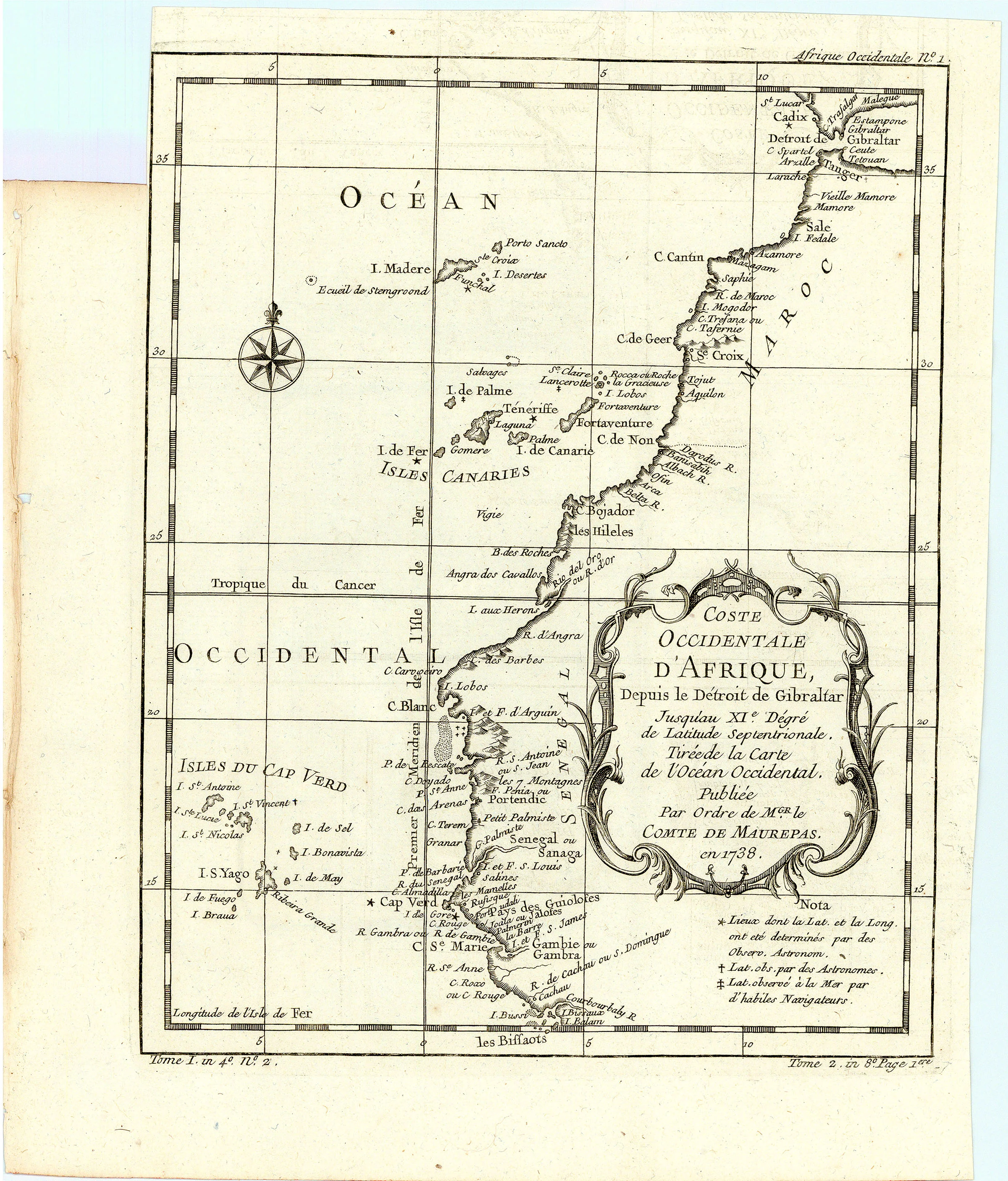
Description
- Title: Coste Occidentale d'Afrique
- Author: Jacques-Nicolas Bellin
- Date: 1738
- Medium: Copperplate engraving
- Condition: Good - light age toning, folds, trimmed left margin
- Inches: 9 3/4 x 11 1/2 [Paper]
- Centimeters: 24.77 x 29.21 [Paper]
- Product ID: 102168
Coste Occidentale d'Afrique, Depuis le Détroit de Gibraltar Jusq XIe. Dégré de Latitude Septentrionale. Tirée de la Carte de l'Océan Occidental. Publiée Par Ordre de Mgr. le Comte de Maurepas en 1738.
"West Coast of Africa, From the Strait of Gibraltar Until the 11th Degree of Northern Latitude. From the Map of the Western Ocean Published By Order of Mgr. the Count of Maurepas in 1738."
Map of the western coast of Africa, including present-day Morocco, Western Sahara, Mauritania, Senegal, the Gambia, and Guinea-Bissau by French hydrographer and geographer Jacques-Nicolas Bellin (1703-1772), who produced a prodigious body of work over a nearly fifty-year career. Legend in bottom right corner acknowledges variances in latitude and longitude of certain islands based on different sets of observational data.
Appointed hydrographer of the French Navy at the age of eighteen, Bellin eventually became Hydrographer to the King in 1741. He published numerous sea atlases and charts which would be reprinted into the nineteenth century, as well as many maps depicting French colonial territories in the New World. His craftsmanship and commitment to accuracy earned him a distinguished reputation as one of the world's leading cartographers, and many other European mapmakers turned to him for source material.