Oklahoma: The American Investment Company, c.1905
- Title: The Compliments of The American Investment Company | Atoka, Indian Territory
- Author: The American Investment Company
- Date: c.1905
- Condition: Excellent
- Inches: 13 1/8 x 9 5/8 [Paper]
- Centimeters: 33.33 x 24.44 [Paper]
- Product ID: 308655
"High Grade First Mortgage Real Estate Loans"
This is an early 20th‑century promotional map of Oklahoma that shows counties in contrasting colors with towns, railroads, and rivers carefully engraved, and is bordered by Texas, Kansas, Arkansas, and the Texas Panhandle. At left, a decorative cartouche advertises “High Grade First Mortgage Real Estate Loans,” reflecting the company’s use of the map as a real‑estate investment advertisement just before or around Oklahoma statehood.
Background on Creator
The American Investment Company appears to have been a regional real‑estate and mortgage concern operating out of Atoka in the old Indian Territory (southeastern Oklahoma) in the early 20th century. It promoted “high grade first mortgage real estate loans,” suggesting a focus on financing land purchases and development as non‑Native settlement accelerated around the time of Oklahoma statehood. The company likely used complimentary advertising maps as both promotional gifts and practical tools for prospective investors, highlighting available lands, transportation routes, and growing towns in the new state.
Original: $125.00
-65%$125.00
$43.75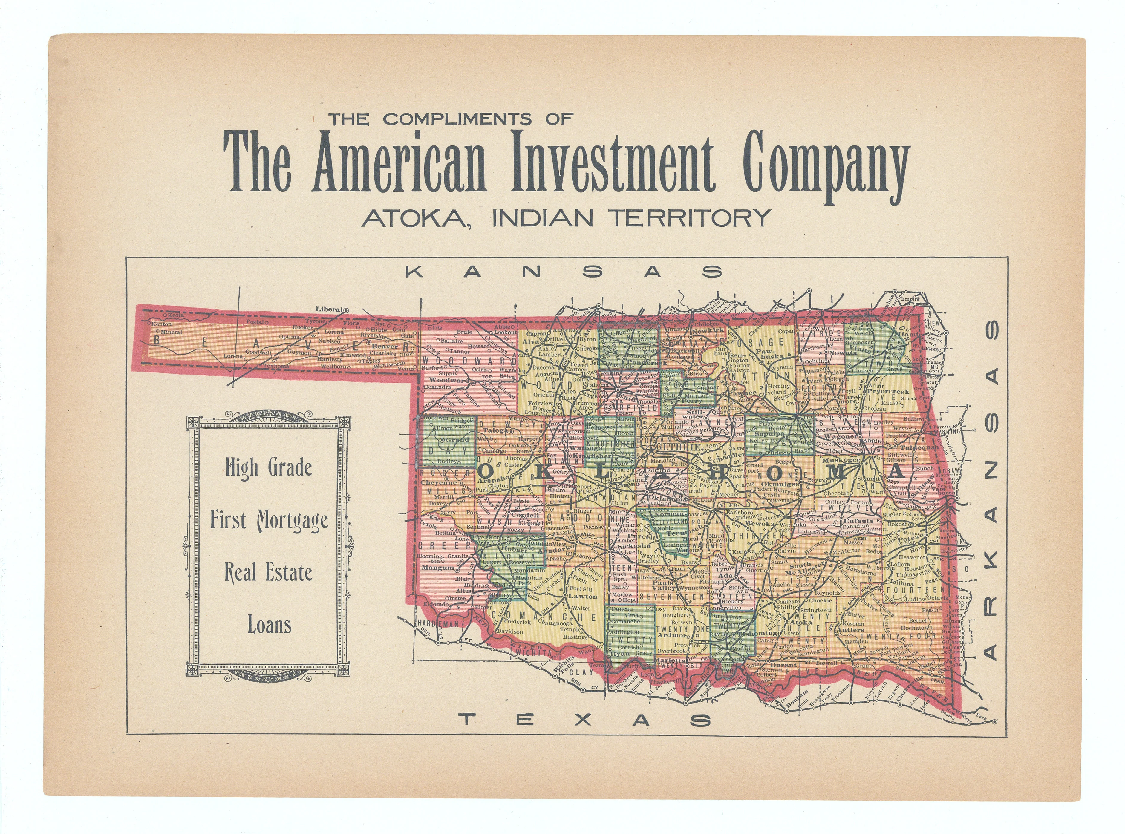
Description
- Title: The Compliments of The American Investment Company | Atoka, Indian Territory
- Author: The American Investment Company
- Date: c.1905
- Condition: Excellent
- Inches: 13 1/8 x 9 5/8 [Paper]
- Centimeters: 33.33 x 24.44 [Paper]
- Product ID: 308655
"High Grade First Mortgage Real Estate Loans"
This is an early 20th‑century promotional map of Oklahoma that shows counties in contrasting colors with towns, railroads, and rivers carefully engraved, and is bordered by Texas, Kansas, Arkansas, and the Texas Panhandle. At left, a decorative cartouche advertises “High Grade First Mortgage Real Estate Loans,” reflecting the company’s use of the map as a real‑estate investment advertisement just before or around Oklahoma statehood.
Background on Creator
The American Investment Company appears to have been a regional real‑estate and mortgage concern operating out of Atoka in the old Indian Territory (southeastern Oklahoma) in the early 20th century. It promoted “high grade first mortgage real estate loans,” suggesting a focus on financing land purchases and development as non‑Native settlement accelerated around the time of Oklahoma statehood. The company likely used complimentary advertising maps as both promotional gifts and practical tools for prospective investors, highlighting available lands, transportation routes, and growing towns in the new state.