Carte de la Baye de Hudson: Bellin 1757
- Title: Carte de la Baye de Hudson
- Author: Jacques-Nicolas Bellin
- Date: 1757
- Medium: Copperplate engraving
- Condition: Very Good Plus - light age toning, issued center fold
- Inches: 13 1/2 x 9 5/8 [Paper]
- Centimeters: 34.29 x 24.45 [Paper]
- Product ID: 102136
Carte de la Baye de Hudson, Pour servir à l'Histoire Générale des Voyages. Echelle de Lieues communes de France. Par M. B. Ingr. de la Marine 1757.
"Map of Hudson Bay, for use in the General History of Travel. Scale of common leagues of France. By M. Bellin Naval Engineer 1757."
Map of Hudson Bay in Canada by French hydrographer and geographer Jacques-Nicolas Bellin (1703-1772), who produced a prodigious body of work over a nearly fifty-year career. Includes portions of the provinces of Labrador, Newfoundland, Ontario, Manitoba, Quebec, and Nunavut.
Appointed hydrographer of the French Navy at the age of eighteen, he eventually became Hydrographer to the King in 1741. He published numerous sea atlases and charts which would be reprinted into the nineteenth century, as well as many maps depicting French colonial territories in the New World. His craftsmanship and commitment to accuracy earned him a distinguished reputation as one of the world's leading cartographers, and many other European mapmakers turned to him for source material.
Original: $125.00
-65%$125.00
$43.75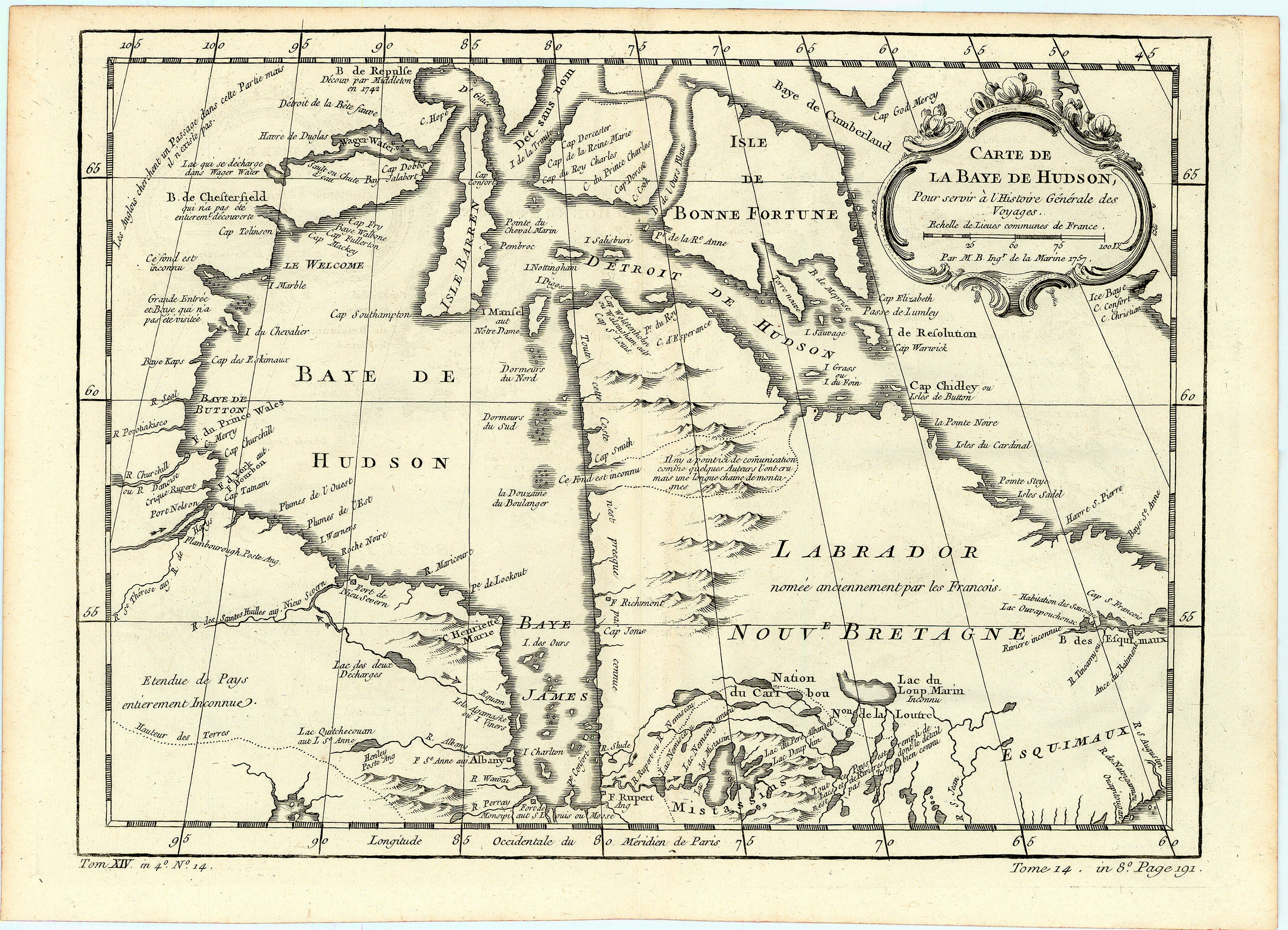
Description
- Title: Carte de la Baye de Hudson
- Author: Jacques-Nicolas Bellin
- Date: 1757
- Medium: Copperplate engraving
- Condition: Very Good Plus - light age toning, issued center fold
- Inches: 13 1/2 x 9 5/8 [Paper]
- Centimeters: 34.29 x 24.45 [Paper]
- Product ID: 102136
Carte de la Baye de Hudson, Pour servir à l'Histoire Générale des Voyages. Echelle de Lieues communes de France. Par M. B. Ingr. de la Marine 1757.
"Map of Hudson Bay, for use in the General History of Travel. Scale of common leagues of France. By M. Bellin Naval Engineer 1757."
Map of Hudson Bay in Canada by French hydrographer and geographer Jacques-Nicolas Bellin (1703-1772), who produced a prodigious body of work over a nearly fifty-year career. Includes portions of the provinces of Labrador, Newfoundland, Ontario, Manitoba, Quebec, and Nunavut.
Appointed hydrographer of the French Navy at the age of eighteen, he eventually became Hydrographer to the King in 1741. He published numerous sea atlases and charts which would be reprinted into the nineteenth century, as well as many maps depicting French colonial territories in the New World. His craftsmanship and commitment to accuracy earned him a distinguished reputation as one of the world's leading cartographers, and many other European mapmakers turned to him for source material.